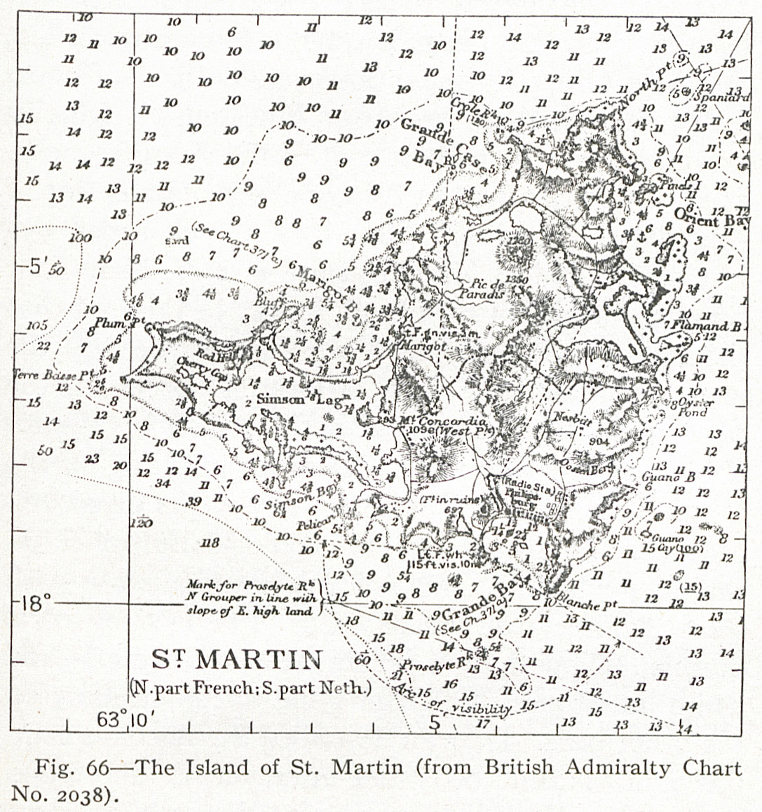
Fig. 66 — The Island of St. Martin (from British Admiralty Chart No. 2038).
Contenu
-
Identifiant
-
NAN130340201i1
-
Légende
-
Fig. 66 — The Island of St. Martin (from British Admiralty Chart No. 2038).
-
Page
-
p. 167
-
Numéro
-
167
-
Description
-
Carte topographique de l'île de Saint Martin
-
Mot-clé Siècle
-
19
-
Type
-
fr
Carte, plan
-
Format
-
image/jpeg
-
Conditions d'utilisation
-
fr
Domaine public
-
Plateforme source
-
Bibliothèque numérique Manioc
Ressources liées
Contenus avec " Contient : Fig. 66 — The Island of St. Martin (from British Admiralty Chart No. 2038). "
| Titre |
Classe |
 The Lesser Antilles The Lesser Antilles |
Texte
|