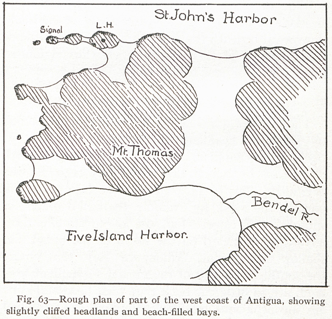
Fig. 63 — Rough plan of part of the west coast of Antigua, showing slightly cliffed headlands and beach-filled bays.
Contenu
-
Identifiant
-
NAN130340192i2
-
Légende
-
Fig. 63 — Rough plan of part of the west coast of Antigua, showing slightly cliffed headlands and beach-filled bays.
-
Page
-
p. 158
-
Numéro
-
158
-
Description
-
Dessin d'un plan sommaire de la côte ouest d'Antigua
-
Mot-clé Siècle
-
19
-
Type
-
fr
Carte, plan
-
Format
-
image/jpeg
-
Conditions d'utilisation
-
fr
Domaine public
-
Plateforme source
-
Bibliothèque numérique Manioc
Ressources liées
Contenus avec " Contient : Fig. 63 — Rough plan of part of the west coast of Antigua, showing slightly cliffed headlands and beach-filled bays. "
| Titre |
Classe |
 The Lesser Antilles The Lesser Antilles |
Texte
|