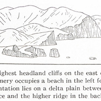
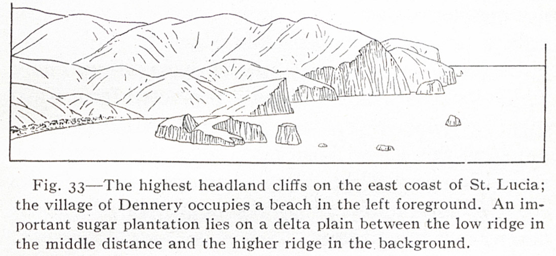
Fig- 33 — The highest headland cliffs on the east coast of St. Lucia; the village of Dennery occupies a beach in the left foreground. An important sugar plantation lies on a delta plain between the low ridge in the middle distance and the higher ridge in the background.
Contenu
-
Identifiant (dcterms:identifier)
-
NAN130340115i1
-
Légende (dcterms:title)
-
Fig- 33 — The highest headland cliffs on the east coast of St. Lucia; the village of Dennery occupies a beach in the left foreground. An important sugar plantation lies on a delta plain between the low ridge in the middle distance and the higher ridge in the background.
-
Page (bibo:locator)
-
p. 87
-
Numéro (bibo:number)
-
87
-
Description (dcterms:description)
-
Dessin vue de mer de la côte Est de Sainte Lucie
-
Mot-clé Siècle (dcterms:temporal)
-
19
-
Type (dcterms:type)
-
Dessin, estampe, peinture
-
Format (dcterms:format)
-
image/jpeg
-
Conditions d'utilisation (dcterms:rights)
-
fr
Domaine public
-
Plateforme source (dcterms:provenance)
-
Bibliothèque numérique Manioc
 The Lesser Antilles
 Service commun de la documentation de l’Université de Nantes